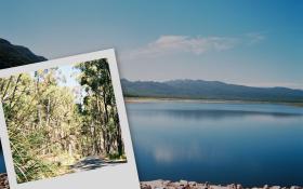
Ride Statistics
Total Distance:
7.10km | 4.41mi
Starting Altitude:
300m | 984ft
Finishing Altitude:
680m | 2,231ft
Average Gradient: 5.3%
Elevation Gain:
380m | 1,247ft
Surface Type:
Smooth Bitumen / Asphalt
Difficulty: 49

sundial picnic area from lake bellfield Hill Climb

Distance: 7.10km | 4.41mi
Attempts: 7
Elevation Profile

Directions
Lake bellfield is a few kms south of halls gap & the climb starts halfway along the lake
Start Point: Colin junctoin , ( T intersection of grampians tourist rd with siverband rd)., stationary
End point: Sundial picnic area
Fastest Hill Climbs
View All Attempts
| Enter My Attempt
1.
23mins 23secs
- 19 Oct 2005:
Bruce Martin
2.
26mins 9secs
- 28 Oct 2005:
Michael Conan-Davies
3.
26mins 20secs
- 11 Jun 2009:
Tim Aplin
4.
29mins 25secs
- 13 Jan 2004:
Nick .
5.
30mins 55secs
- 21 Mar 2005:
Dennis Ray
View All Attempts »
Comments
Currently No Comments