Ride Statistics
Total Distance:
42.00km | 26.10mi
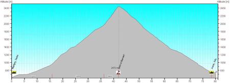
Starting Altitude:
477m | 1,565ft
Finishing Altitude:
2,473m | 8,114ft
Average Gradient: 4.4%
Elevation Gain:
1,996m | 6,549ft
Surface Type:
Smooth Bitumen / Asphalt
Difficulty: 156

col de Gran san Bernard Hill Climb

Distance: 42.00km | 26.10mi
Attempts: 2
Elevation Profile

Directions
Climb starts in the Town of Martigny in the south west corner of Switzerland vey close to a meeting of the three borders for France Italy & switzerland. Closest city;Geneva. Just follow the national 21 from Martigny to Aosta in Italy.
Start Point: roundabout at the junction of the aosta & chamonix roads., rolling
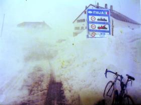
End point: Swiss italian border at the top.
Fastest Hill Climbs
View All Attempts
| Enter My Attempt
1.
2hrs 29mins 15secs
- 10 Oct 2015:
Nick .
View All Attempts »
Comments
Currently No Comments