Ride Statistics
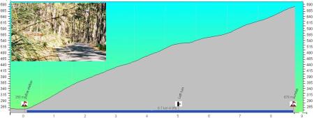
Total Distance:
8.60km | 5.34mi
Starting Altitude:
250m | 820ft
Finishing Altitude:
680m | 2,231ft
Average Gradient: 5.0%
Elevation Gain:
430m | 1,411ft
Surface Type:
Smooth Bitumen / Asphalt
Difficulty: 50

Sundial picnic area Hill Climb

Distance: 8.60km | 5.34mi
Attempts: 2
Elevation Profile

Directions
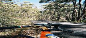
Take the Mount victory rd from halls gap then fork left onto the sundial rd 1/3rd of the way up.
Start Point: halls gap police station, rolling
End point: Sundial picnic area
Fastest Hill Climbs
View All Attempts
| Enter My Attempt
1.
31mins 27secs
- 15 Jan 2004:
Nick .
2.
32mins 43secs
- 28 Oct 2005:
Michael Conan-Davies
View All Attempts »
Comments
Currently No Comments