Ride Statistics
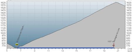
Total Distance:
13.84km | 8.60mi
Starting Altitude:
686m | 2,251ft
Finishing Altitude:
1,572m | 5,157ft
Average Gradient: 6.4%
Elevation Gain:
885m | 2,904ft
Surface Type:
Smooth Bitumen / Asphalt
Difficulty: 96

Montage de Lure Hill Climb

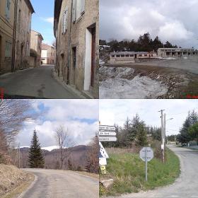
Very peacefull narrow road . I was only able to get to the cafes & ski lift ( due to snow )where the 2009 Paris - Nice stage finished but theres more road 'signal' du Lure.
Distance: 13.84km | 8.60mi
Attempts: 2
Elevation Profile

Directions
Take the turning just west of the Village of St Ettiene , it's signed for 'Montagne du Lure '.
Start Point: T junction at the start of the ascent on the western side of town., rolling
End point: Cafes & buildings where the road widens & splits two ways.
Map & Route to Montage de Lure
Summary

Fastest Hill Climbs
View All Attempts
| Enter My Attempt
1.
55mins 43secs
- 06 Apr 2009:
Nick .
View All Attempts »
Comments
Currently No Comments