Ride Statistics
Total Distance:
152.94km | 95.03mi
Starting Altitude:
1,178m | 3,865ft
Finishing Altitude:
1,176m | 3,858ft
Average Gradient: 0.0%
Elevation Gain:
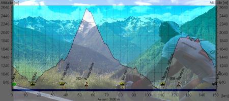
3,500m | 11,483ft
Surface Type:
Smooth Bitumen / Asphalt
Difficulty: 153

Medio Fondo Marco Pantani. Hill Climb

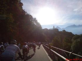
Starts with a 15km descent to Edolo before climbing the Gavia via Ponte Legno . Then it's more or less all downhill via Bormio to the foot of the Mortirolo at Mazzo Valtelina. From the summit of the Mortirolo the route follows a very small country lane across a ridge ( awsome views down into the Tirano Valley from that road ! ) back towards Aprica with final swooping descent that takes you right into the Town of Aprica & the finish.
Distance: 152.94km | 95.03mi
Attempts: 1
Elevation Profile

Directions
Aprica is north east of Milan in the region of Tirano. The google map doesn't allow me to use the small road across from the Mortirolo to the finish so i had to route it using the valley road but the distance is still correct .
Start Point: Centre of Aprica ., stationary
End point: Centre of Aprica.
Map & Route to Medio Fondo Marco Pantani.
Summary

Fastest Hill Climbs
View All Attempts
| Enter My Attempt
1.
8hrs 5mins 41secs
- 29 Jun 2009:
Nick .
View All Attempts »
Comments
Currently No Comments