Ride Statistics
Total Distance:
29.00km | 18.02mi
Starting Altitude:
700m | 2,297ft
Finishing Altitude:
2,068m | 6,785ft
Average Gradient: 4.6%
Elevation Gain:
1,450m | 4,757ft
Surface Type:
Rough Bitumen / Asphalt
Difficulty: 122

Croix de fer(from st jean de Maurienne Hill Climb

Distance: 29.00km | 18.02mi
Attempts: 2
Directions
Follow the signs for Valley d'Arvan ,st sorlin de Arves, croix de fer on the D926 from st jean. Nearest city: Chambery.
Start Point: St jean de Maurienne, rolling
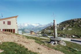
End point: Cafe at the top.
Map & Route to Croix de fer(from st jean de Maurienne
Summary

Fastest Hill Climbs
View All Attempts
| Enter My Attempt
1.
2hrs 10mins 12secs
- 29 Jun 2004:
Nick .
View All Attempts »
Comments
Currently No Comments