Ride Statistics
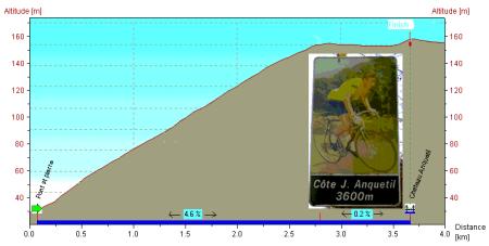
Total Distance:
3.60km | 2.24mi
Starting Altitude:
18m | 59ft
Finishing Altitude:
147m | 482ft
Average Gradient: 3.6%
Elevation Gain:
130m | 427ft
Surface Type:
Smooth Bitumen / Asphalt
Difficulty: 23

Cote de Jacques Anquetil. Hill Climb

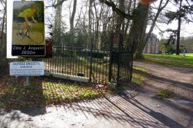
A pretty little climb that starts at the T intersection the D321 & D126 in the village of Romily sur Andelle. There are a series of distance marker road signs on the climb with a picture of Jacques Anquetil on them .
Distance: 3.60km | 2.24mi
Attempts: 5
Elevation Profile

Directions
Follow the D126 up towards Boos airport .
Start Point: First Anquetil distance marker at T junction., rolling
End point: Last marker opposite gates to Jacques Anquetil Chateau.
Map & Route to Cote de Jacques Anquetil.
Summary

Fastest Hill Climbs
View All Attempts
| Enter My Attempt
1.
9mins 6secs
- 04 Aug 2012:
Nick .
View All Attempts »
Comments
Currently No Comments