Ride Statistics
Total Distance:
10.34km | 6.42mi
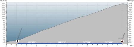
Starting Altitude:
530m | 1,739ft
Finishing Altitude:
1,380m | 4,528ft
Average Gradient: 8.2%
Elevation Gain:
854m | 2,802ft
Surface Type:
Rough Bitumen / Asphalt
Difficulty: 113

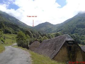
Col de Spandelles - west side. Hill Climb

Tiny road between Ferriers & Argeles Gazost.
Distance: 10.34km | 6.42mi
Attempts: 1
Elevation Profile

Directions
Turn off from Col de Soulor road is just north of Ferriers.
Start Point: Junction with Col de Soulor road., rolling
End point: Col sign at summit
Map & Route to Col de Spandelles - west side.
Summary

Fastest Hill Climbs
View All Attempts
| Enter My Attempt
1.
1hr 5mins 47secs
- 23 Jul 2010:
Nick .
View All Attempts »
Comments
Currently No Comments