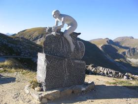
Ride Statistics
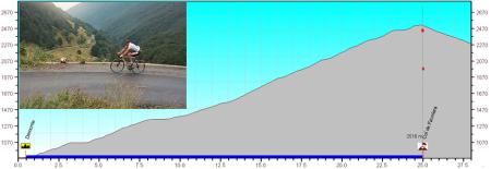
Total Distance:
25.20km | 15.66mi
Starting Altitude:
780m | 2,559ft
Finishing Altitude:
2,416m | 7,927ft
Average Gradient: 6.4%
Elevation Gain:
1,630m | 5,348ft
Surface Type:
Smooth Bitumen / Asphalt
Difficulty: 157

Col de Fauniera Hill Climb

Distance: 25.20km | 15.66mi
Attempts: 5
Elevation Profile

Directions
Turn right at end of market square in Demonte {near Cuneo} signed for Vallone dell Arma.
Start Point: Demonte, rolling
End point: Col de fauniera altitude sign.
Map & Route to Col de Fauniera
Summary

Fastest Hill Climbs
View All Attempts
| Enter My Attempt
1.
1hr 50mins 0secs
- 18 May 2003:
Nick .
View All Attempts »
Comments
Currently No Comments