Ride Statistics
Total Distance:
18.29km | 11.36mi
Starting Altitude:
695m | 2,280ft
Finishing Altitude:
1,434m | 4,705ft
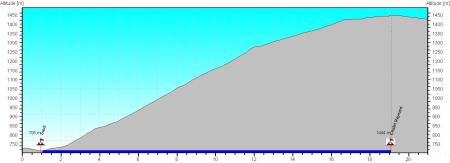
Average Gradient: 4.0%
Elevation Gain:
740m | 2,428ft
Surface Type:
Smooth Bitumen / Asphalt
Difficulty: 64

Chalet Reynard from Sault Hill Climb

Distance: 18.29km | 11.36mi
Attempts: 1
Elevation Profile

Directions
Start Point: Nesque river bridge, rolling
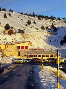
End point: Cafe at Chalet Reynard.
Map & Route to Chalet Reynard from Sault
Summary

Fastest Hill Climbs
View All Attempts
| Enter My Attempt
1.
1hr 2mins 58secs
- 01 Jan 2005:
Nick .
View All Attempts »
Comments
Currently No Comments